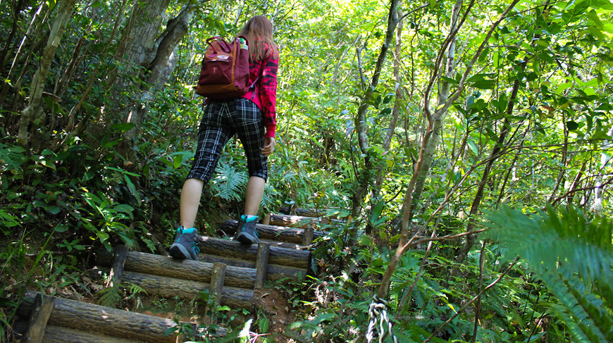
The Hike
The trail is quite a pleasant walk up to the waterfall, it will get steeper after that but the more difficult parts have been fitted with steps. However, it is strongly advised that you do not attempt to hike it on a rainy day because the trail will quickly turn into a mudslide.
FACTS
Height: 525.5 meters
Time: 90min one way ( the waterfall is about 30min)
Bring: Plenty of water, good shoes, and wear long pants
 It will take around 90 minutes to get to the summit from the entrance of the trail. If you want to stop for a couple of breaks and take pictures, plan for 2 hours to be safe. If you are fit and walk at a fast pace without stopping, the hike could probably be done in a sweaty 60 minutes. Be sure to plan your hike according to your fitness level and the weather, nightfall comes swiftly in Ishigaki and you do not want to stumble around in the jungle after dark.
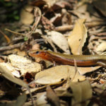
The path itself is mostly inside the forest. You will probably see a few small lizards scurrying across it as you walk, and if you are lucky you might see one of the rarer Nihon-Tokage lizards with their beautiful blue tail. Ishigaki is also home to the Habu snake so be careful where you step.
Be sure to bring plenty of water with you as it can get very hot and humid inside the jungle, especially during the summer months. You will also need hiking shoes/sneakers since there could be venomous snakes and a firm grip will make the hike much more enjoyable. Long pants are also recommended for both mosquitoes and the prickly bamboo grass.
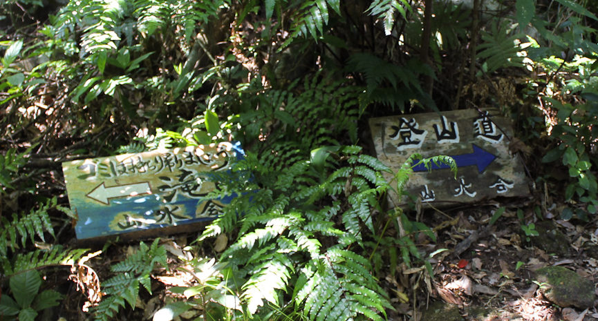
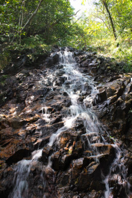
Signboard to the waterfall (turn left)
The waterfall is roughly 1/3 of the way up and the way is marked by a signboard (above). This part of the way is the easiest and most fun (I think).You can even get a limited view of the island from a clearing just before the waterfall. If you feel like you are too tired/hot, or the trail was tougher than you expected, consider turning back here.
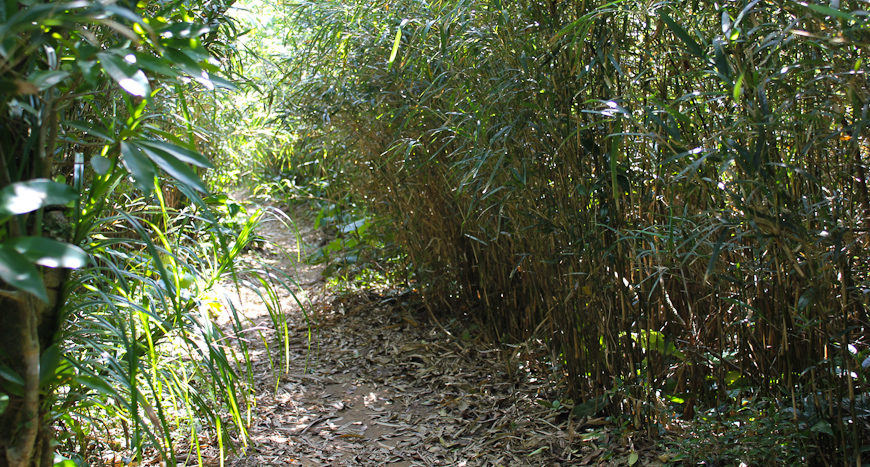
Thick bamboo grass on the path to the top
Once you reach the top, pass the big communication tower and take the path to the left.
Congratulations! You have reached the highest peak in Okinawa ^_^
Spend some time to enjoy the stunning view and don’t miss to check out the path going to the right as well. You will be awarded by a real nice view of Ishigaki’s east coast and it is only a few steps further to go.
Getting Here
? By Car— From Ishigaki City, take road 87 and drive until you see the road sign for Mt. Omoto (in English) and take left there. Continue straight until you see the gravel road in the picture below, turn right here. The road is in quite a bad shape so drive carefully. There is a small car parking at the end of the road right by the entrance to the track (second picture).
? By Bus— The entrance to the trail is about 1.7km from the bus stop. If you go by bus, you need to bring extra water and add another 30 minutes (1-hour return) to your hiking time. There are only two busses leaving from Ishigaki city or Kabira to Omoto a day so be sure to check the timetable beforehand. Get off at the Omoto bus stop and (coming from Ishigaki city) continue in the same direction as the bus for about 20 meters. Opposite direction if you came from Kabira. You will see the road sign for Mt. Omoto (in English), follow that road until you see the gravel road in the picture below, turn right here. At the end of the road you will find the entrance to the track (second picture).
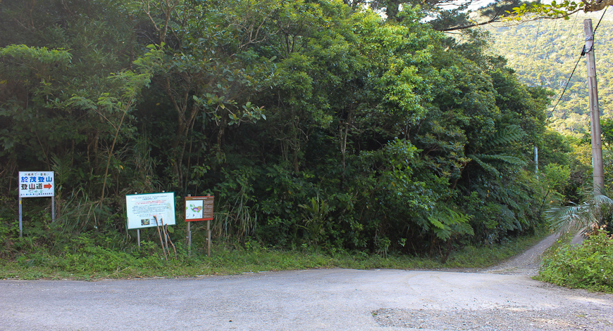
Gravel road leading to the trail
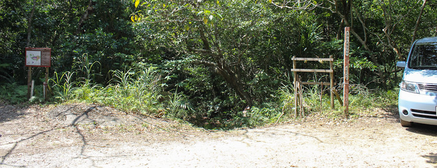
Entrance to the trail and the small car parking
Map
This map shows the way from the bus stop to the gravel road where you turn right. It is the same road if you go by car.